GYRO Software for drilling survey and north seeking
An integrated workflow for project management, device communication, gyro north seeking, survey calculation, trajectory display, and report output.
Software Capability
Integrated project setup, device control, north seeking, and deliverable output
Software Overview
A measurement-control and calculation platform for field gyro survey operations
GYRO software runs in a Windows desktop environment and supports field operation of gyro survey tools. It brings project setup, instrument control, north-seeking execution, inclination and azimuth acquisition, trajectory calculation, graphical display, and report output into one workflow.
Project creation, opening, saving, and project information management
Device communication, connection-status confirmation, depth setup, latitude setup, and TFO management
Survey calculation, 3D trajectory display, data export, and operation report generation
Project Management
Unified project information and operation data management
North-Seeking Control
Warm-up, process control, and result recording
Trajectory Calculation
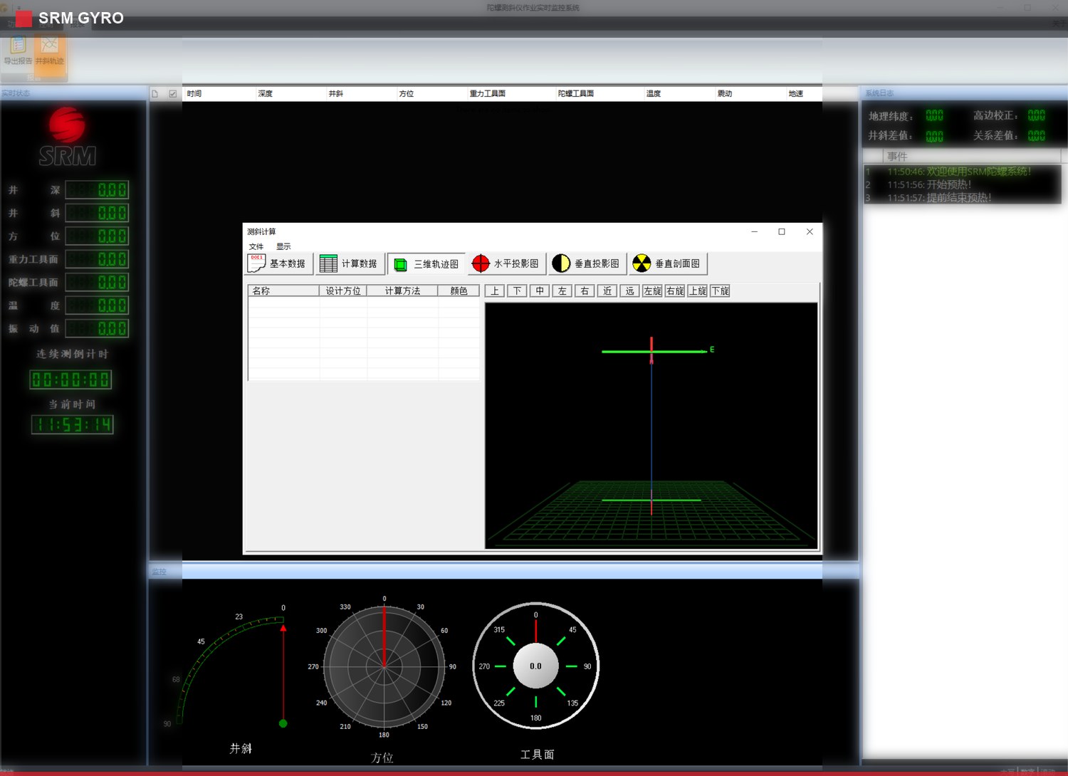
Trajectory, projection, and section display
Report Management
Result export and report generation
Functional Modules
Core Functional Modules
Project Setup
Unified project information and operation data management
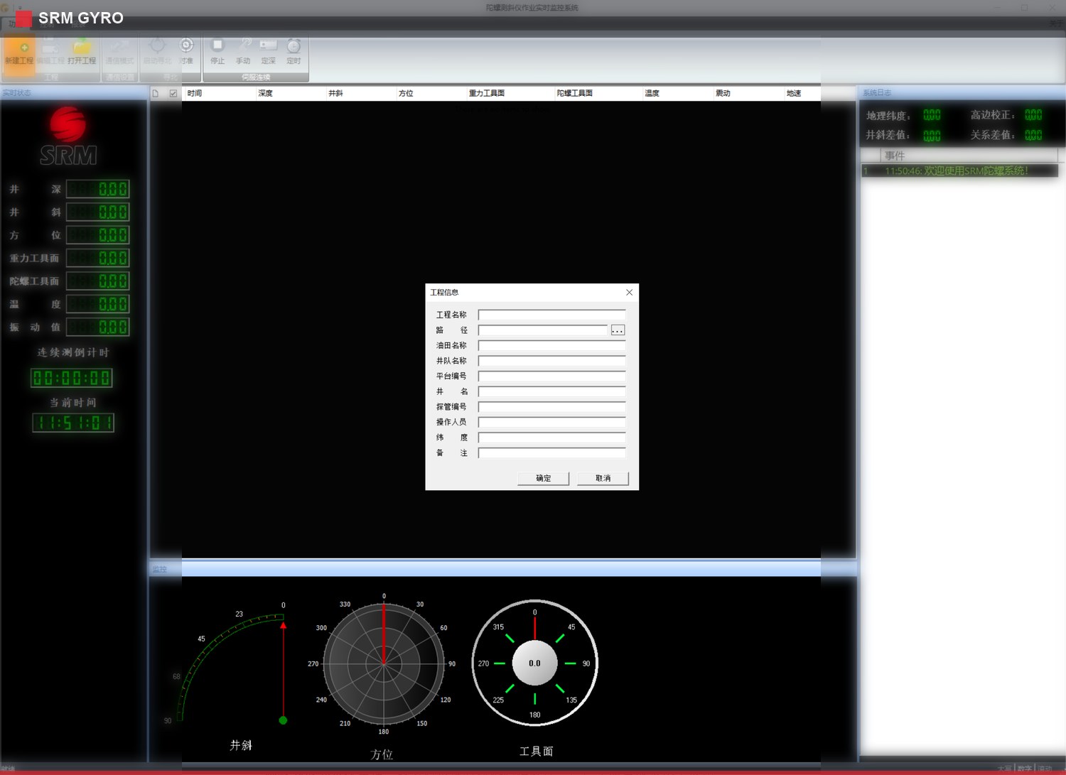
Supports project creation, opening, saving, and project information management. Field, rig, well, probe, operation parameters, and remarks can be organized in one project file for review and records management.
Maintain field, rig, well, and probe information in one place
Save operation parameters, paths, and remarks
Provide a project basis for review and records management
Device Connection
Field communication and status confirmation entry
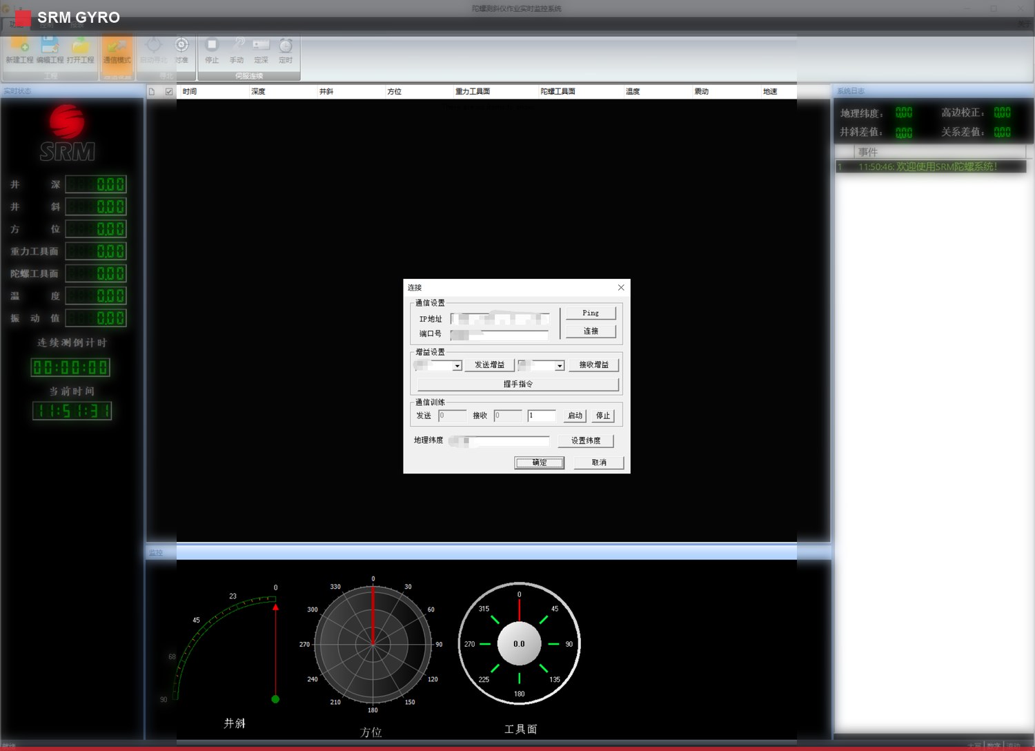
Supports gyro device communication and status coordination, including network connectivity testing, device connection, handshake confirmation, status inquiry, and real-time log display.
Complete network connectivity testing and device connection
Confirm handshake status, device status, and real-time logs
Help field teams judge communication stability quickly
North Seeking
Parameter control for the north-seeking process
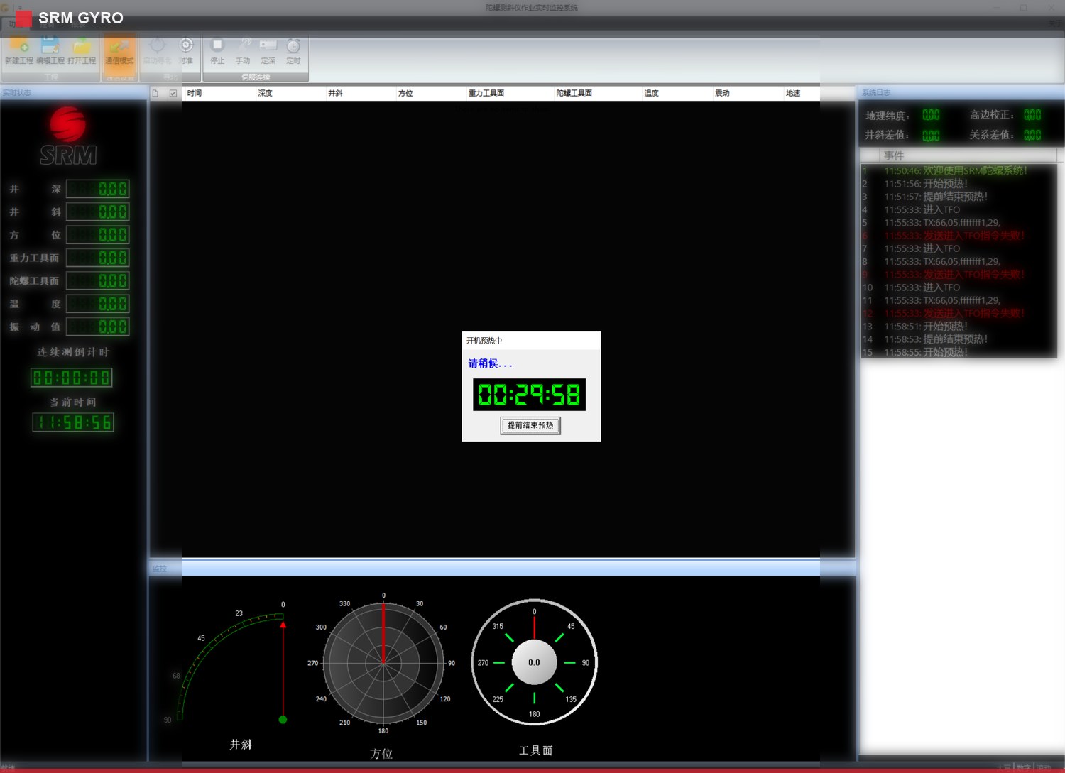
Supports start-up warm-up, gyro north seeking, continuous north-seeking duration, vibration protection threshold, TFO setup and verification, vessel-heading alignment, and latitude setting for offshore and onshore operations.
Support warm-up, north seeking, and duration settings
Configure vibration thresholds, TFO setup, and verification
Adapt to offshore platform and onshore wellsite conditions
Trajectory Calculation
Survey data processing and compensation calculation
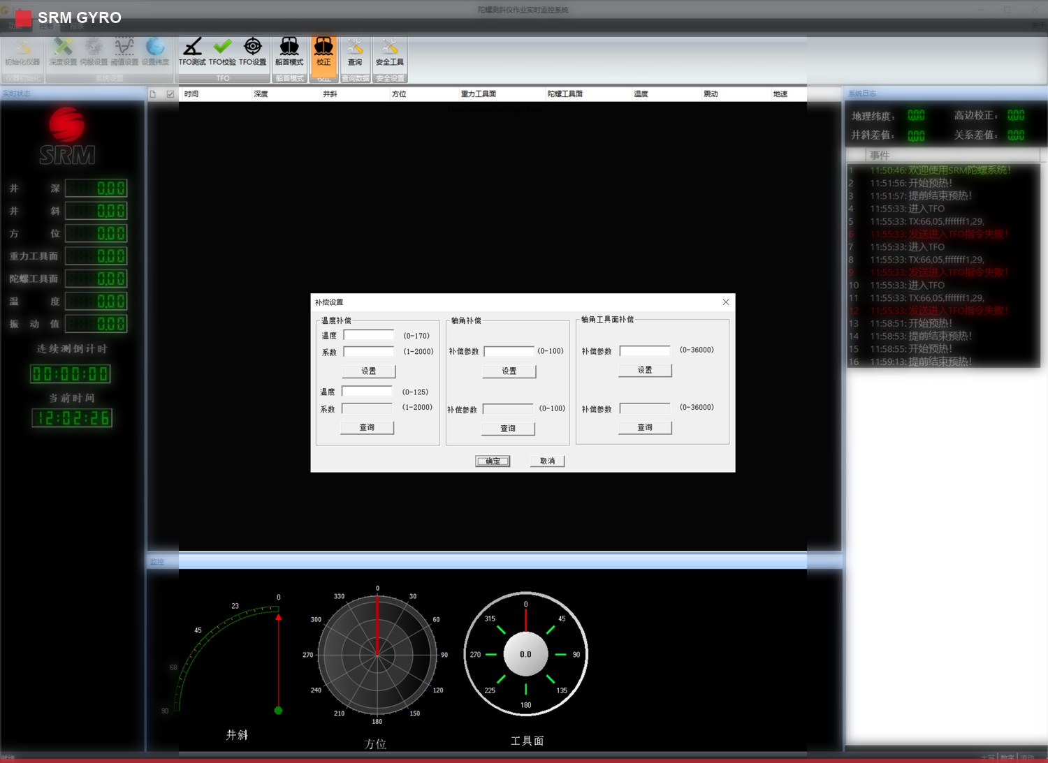
Supports adding, editing, deleting, importing, exporting, and saving base survey data, as well as survey calculation, offset comparison, and compensation parameter processing.
Manage base survey data editing, import, and export
Perform survey calculation, offset comparison, and compensation setup
Improve field data processing and review efficiency
Visualization
Multi-view wellbore trajectory review
Supports 3D trajectory, horizontal projection, vertical projection, and vertical section views, with pan, zoom, rotate, and recenter operations for trajectory interpretation.
Review 3D trajectory, horizontal projection, and vertical projection views
Support pan, zoom, rotate, and recenter operations
Analyze the wellbore trajectory from multiple perspectives
Reports & Logs
Traceable operation records for delivery
Supports test reports, operation reports, and calculated data outputs. System logs and real-time status areas record connection, north-seeking, acquisition, and key operation events.
Output test reports, operation reports, and calculated data
Record connection, north-seeking, acquisition, and key operations
Support operation review, material delivery, and traceability
Interface Views
Core screens from project setup to trajectory display
The following interface views highlight project management, device connection, parameter setup, north-seeking control, and trajectory display modules.
Project setup: project, wellsite, instrument, and operation parameters organized in one workspace.
Device connection: communication test, device connection, and status confirmation.
Parameter setup: depth, TFO, compensation, and operation condition configuration.
North-seeking process: warm-up, execution progress, and key operation status.
Trajectory display: 3D trajectory, projection, and section view support.
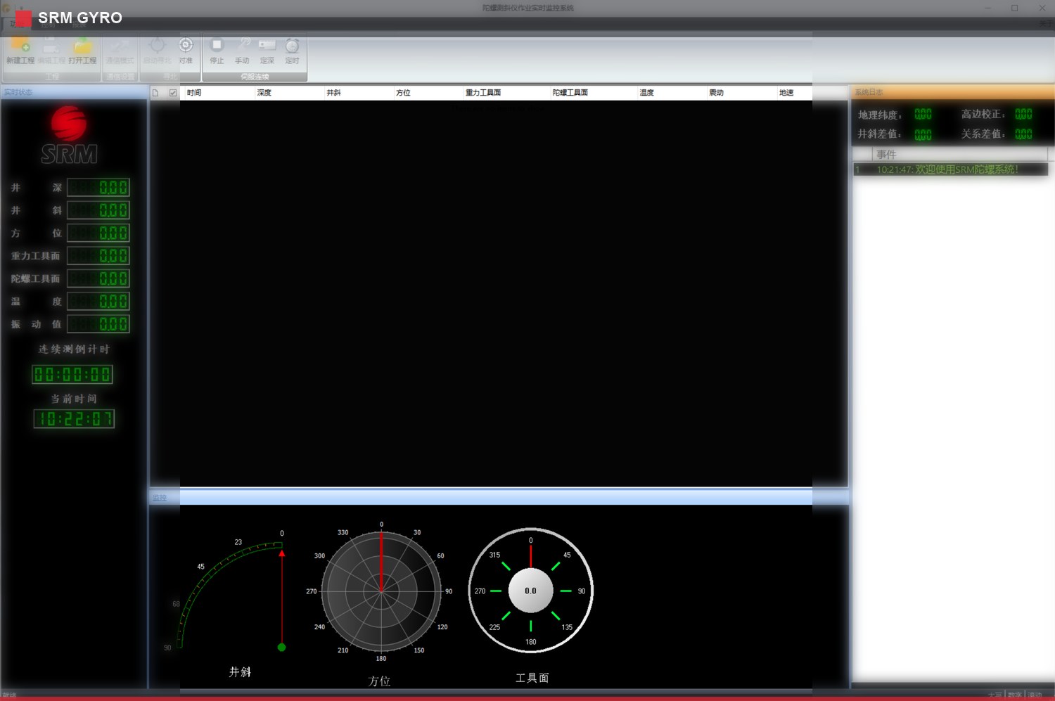
Main interface: real-time monitoring, data list, status area, and graphical display.
Workflow
Closed-loop workflow from project setup to deliverable output
01 Project Setup
Create the operation project and maintain well, platform, probe, latitude, and remark information.
02 Communication
Complete device connection, status inquiry, communication confirmation, and real-time log confirmation.
03 Parameter Setup
Set depth mode, step size, TFO, vessel-heading alignment, north-seeking duration, and vibration threshold.
04 North Seeking
Execute warm-up, north seeking, acquisition tests, and key measurement parameter recording.
05 Calculation
Manage base data, perform survey calculation, offset comparison, and compensation processing.
06 Visualization
Review 3D trajectory, horizontal projection, vertical projection, and section views.
07 Report Output
Generate test reports, operation reports, and calculated result files.
08 Traceability
Use system logs and real-time status records to review operation processes and exceptions.
Field Value
Coordinated capability for field gyro survey operations
Standardized workflow
Project information, parameter setup, instrument control, data acquisition, and deliverable output are integrated into one workflow.
Efficient data processing
Survey data can be entered, checked, calculated, visualized, and exported within the software to support field decision-making.
Traceable operation record
Logs, real-time status, and report outputs record device connection, north-seeking execution, acquisition tests, and key operations.
Image Gallery
GYRO Software Operation Image
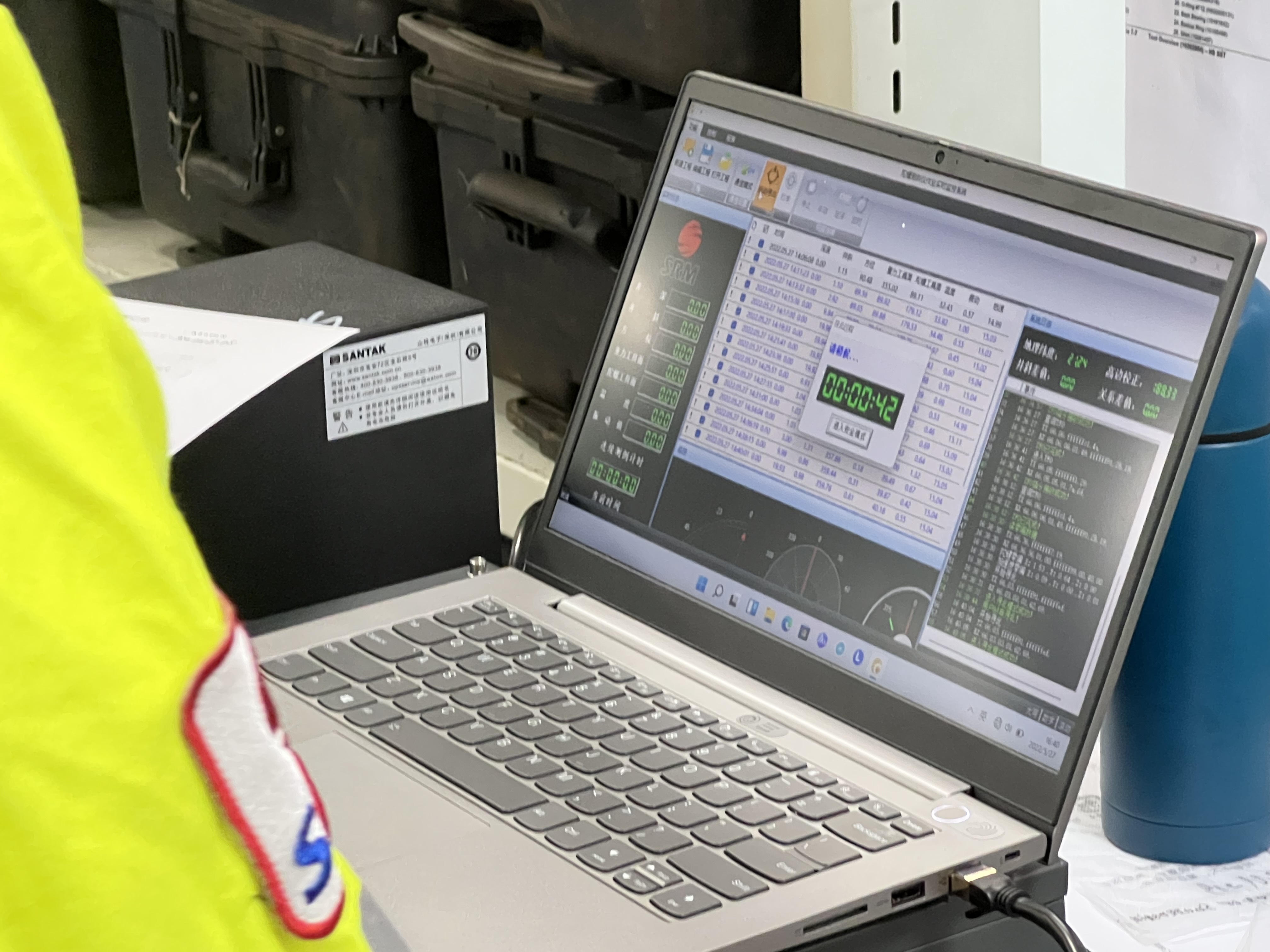
Field operation scene and software interface views show how GYRO software is used in practice.
GYRO software operation and data processing scene.GYRO software main interface.GYRO software trajectory display interface.
Material Service
Related Operation Materials
[CN] Integrated Continuous Gyro Survey Tool Operation ManualChinese operation manual for tool operation, deployment, measurement workflow, and field use.